There's a moment, the first time you stand above the Răut River at Old Orhei, when you stop talking. It's not something anyone warns you about, you just find yourself standing at the edge of the cliff, looking down at the river bending around the rock, and realizing that people have been standing in roughly …
The History of Old Orhei: From Natural Formation to Ancient Civilizations
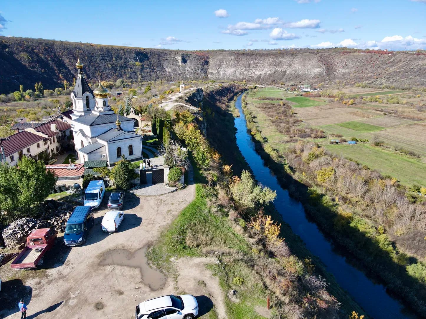
There’s a moment, the first time you stand above the Răut River at Old Orhei, when you stop talking. It’s not something anyone warns you about, you just find yourself standing at the edge of the cliff, looking down at the river bending around the rock, and realizing that people have been standing in roughly this same spot, looking at roughly this same view, for thousands of years.
Orheiul Vechi is currently in the process of being nominated for UNESCO’s World Heritage List, and standing here, that’s not hard to understand. This isn’t one historical site. It’s several, layered on top of each other across a few dozen hectares, two large promontories, Peștere and Butuceni, plus three smaller ones next door, Potarca, Selitra, and Scoc. Between them: the ruins of fortifications, homes, bathhouses, and places of worship, including cave monasteries, spanning both the Tatar-Mongol period of the 13th–14th centuries and the Moldovan period that followed in the 15th–16th.
The Canyon Itself
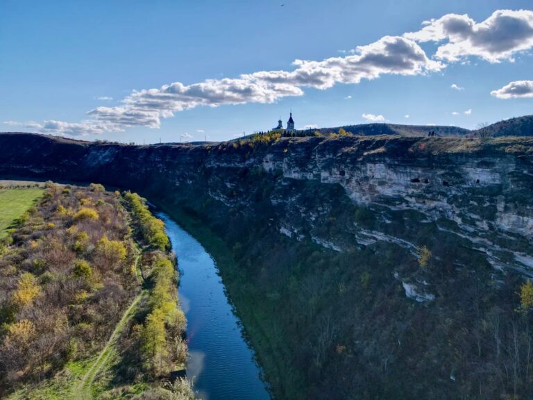
Before any of that history, there was just limestone and time. The rock that makes up these cliffs was laid down roughly 13 million years ago, sediment settling at the bottom of the shallow Sarmatian Sea that once covered this part of the world, long before anything resembling modern Moldova existed. Layer built on layer, compacted, and stayed.
Then the Răut arrived and started cutting. What you’re looking at today is the result: a narrow gorge, rarely more than 1–2 km wide, with banks that curve in tight concave and convex bends, in places nearly vertical, dropping at close to a 90-degree angle. The valley itself reaches depths of 120–130 meters in places. None of this happened quickly. It’s the combined work of river erosion, flash flooding, gravity slowly pulling rock loose, and water dissolving its way through limestone over what geologists count in millions of years. the canyon didn’t just appear, it was carved, patiently, the same way the monks who came here later would carve their own passages into the same stone.
The First People Who Looked at This and Said: Here
The oldest traces of permanent settlement date back to the first millennium BC. The Getae, and later the Dacians, looked at this same limestone promontory and made an obvious calculation: from a 100-meter cliff face, you can see everything, the valley, the river, every road leading in. Any approaching army would be visible hours before it actually arrived.
So they built it here. Archaeologists have found ceramic fragments, remnants of roughly built stone walls, and traces of partially dug-in dwellings. It isn’t a huge amount of material, but it tells you what you need to know: roughly 2,300 years ago, someone stood at this canyon and decided, this is where we build.
What the Dacians didn’t leave behind is monumental architecture. They didn’t carve into the rock or work stone into finished blocks. They built with what they had, wood, earth, rough stone, and most of it hasn’t survived the centuries. But the site they chose says everything about who they were: strategic, practical, with an eye for the landscape that never really left this place.
Shehr al-Jedid: When a Mongol Empire Built a City Here
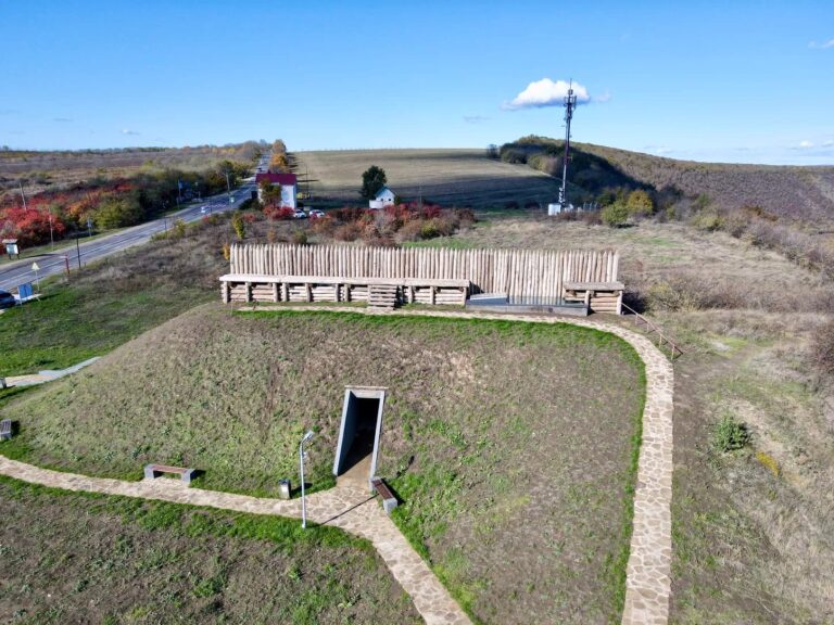
Sometime between 1330 and 1340, this canyon landed on the medieval world’s map. The Golden Horde, the Mongol empire that, at its height, controlled the steppe from Beijing to the Danube, built a city here. Not a camp. Not a garrison. A functioning city, with a mosque, public bathhouses, pottery workshops, and even a sewage system. It was called Shehr al-Jedid, Persian for “New City.”
Archaeologists have since uncovered stone building foundations, coins, glazed ceramics, and objects in bronze and iron. The city is estimated to have covered 40 to 50 hectares, this wasn’t a village, it was a serious urban center, home to thousands of people, sitting on a trade route that connected Crimea to Central Europe. Some sources place the Golden Horde ruler Abdallah Khan here as well, with Orheiul Vechi serving as his residence around 1363–65.
It didn’t last. In 1369, a Lithuanian army under Algirdas destroyed the city. What survived were foundations, fragments, and, if there’s a lesson in it, a fairly blunt one: anything you build can be erased. The plan of it, though, tends to stay in the ground, waiting for someone to dig it back up centuries later.
From Tatar City to Moldovan Fortress
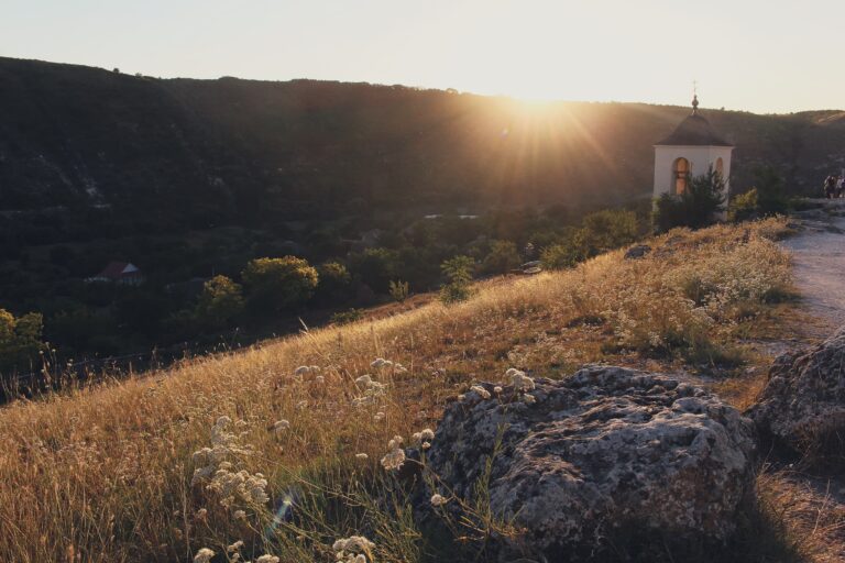
In the last quarter of the 14th century, Moldovans drove the remaining Golden Horde Tatars out of the area, and the site began its transformation from an eastern city into a Moldovan one. Under Ștefan cel Mare, the stone fortress here was repaired, equipped with artillery, and turned into the residence of the pârcălabi (the local military governors) of Orhei.
For a while, the canyon that had already been a Dacian stronghold and a Golden Horde trading city became something new again: a Moldovan military and administrative center, watching the same river bend it always had.
The Fortress Falls Silent
By the mid-16th century, the town’s residents had moved on, literally. They relocated about 15 km northwest and founded a new town, keeping the same name: Orhei, the town that still exists today. That’s the moment this original site quietly became “the old Orhei”, Orheiul Vechi.
The stone fortress itself was destroyed, most likely on the orders of Alexandru Lăpușneanu, who dismantled several fortresses at the request of the Ottomans. Around 1600, ruler Ieremia Movilă made an attempt to rebuild it. It didn’t succeed. After that, the site settled into the quieter existence it’s had ever since, no longer a city or a military post, just a landscape that people kept living alongside.
What’s Still Here
What makes Orheiul Vechi remarkable today isn’t just any single ruin, it’s how much survives layered together across those two large and three small promontories. Fortification remains, foundations of homes and bathhouses, and the cave monasteries carved directly into the cliff face all sit within the same few dozen hectares, spanning both the Tatar-Mongol and Moldovan periods.
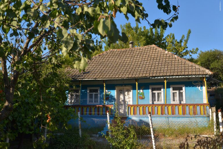
It’s also, unusually for a site this old, still a living landscape, the villages nearby have never been abandoned, the monastery is still active, and the same limestone cliffs that sheltered Dacians, housed a Mongol city, and anchored a Moldovan fortress are still, quietly, exactly where the Răut left them.
Standing There Now
What stays with you, standing above that canyon, isn’t really any single fact, the 13 million years of rock, the 2,300 years since the first settlers, the century a Mongol city stood here before being erased almost as quickly as it rose. It’s the accumulation of all of it in one place. A river cut a canyon with no plan for who would use it. Getae and Dacians saw a fortress in it. The Golden Horde saw a city. Moldova saw a stronghold. And the canyon, through every version of itself, just kept the same shape, waiting for whoever arrived next to look at it and decide what it should become.

GuideMoldova.com
Keep in touch with our news & offers
Subscribe to Our Newsletter
Thank you for subscribing to the newsletter.
Oops. Something went wrong. Please try again later.